Charts for the Cheap: Navigating the Skies Without a Subscription
By: Frank White /FSS Editor
| Region | Recommended Free Source |
|---|---|
| United States | SkyVector / FAA |
| Europe | ChartFox (VATSIM req.) |
| Oceania | Airservices Australia |
| Asia / S. America | Search "[Country] AIP" |
Look, we all know Navigraph is the top dog. It’s slick, it integrates with everything, and it puts professional Jeppesen charts right on your iPad. We highly recommend it. But let’s be real for a second—not everyone can justify the monthly hit to the wallet.
If you only fire up the sim once or twice a month, or maybe just once in a blue moon when the kids are asleep, a subscription feels a bit like overkill. Or maybe you just prefer to spend that cash on a new yoke or scenery. We get it. Life’s expensive, and this hobby ain't exactly cheap.
But that doesn't mean you oughta be flying blind. You can absolutely navigate like a pro without spending a dime—it just requires a little more elbow grease. Here is where the savvy simmer goes to get their data.
The United States: Uncle Sam Provides
If you are flying in the US, you are in luck. The FAA publishes everything for free because, well, you paid for it with your taxes. You can grab the official PDFs directly from the FAA Website, but that can be a bit dry.
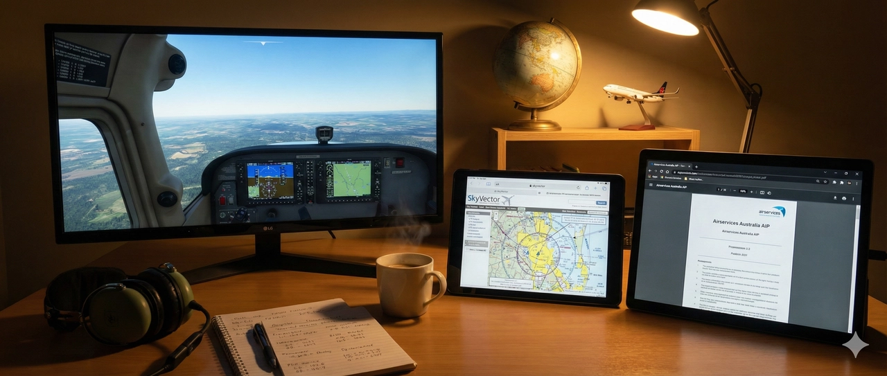
Personally? I prefer SkyVector. It utilizes the exact same real-world aviation charts, but it stitches them together in a slick interface. It even lets you plot your route right on the map. It’s perfect for VFR sectionals and IFR enroute charts. It’s fantastic, it’s visual, and best of all, it’s free.
Europe: The ChartFox Hunt
If you are hopping across the pond, things get a little trickier because every country handles their data differently. But the community has your back.
Check out ChartFox. You’ll usually need a VATSIM account to log in (which is also free), but once you’re in, it’s a goldmine. It pulls real-world charts for most European countries into one interface. It ain't perfect, but for the price of zero dollars, it’s hard to beat.
Down Under (Oceania)
If you’re flying in the land of Oz, you don't need a third-party tool. Airservices Australia publishes their AIP (Aeronautical Information Package) online for free. You can pull up DAPs (Departure and Approach Procedures) right from the source. It’s official data, straight from the government, no subscription required.
Asia & South America: The Wild West
Now, if you are looking for charts in Asia or South America... well, I’ll be honest with you: it’s a bit of a scavenger hunt. However, you should try searching for the countries' name and "AIP" for example, "Brazil AIP". You might just get lucky, and it's not even Saturday night 😅.
We haven't found a single, reliable "all-in-one" free site for these regions yet. Some countries (like Japan and Brazil) have their own government sites where you can dig up charts if you search for their "AIP," but it can be hit or miss. If you know of a secret reliable stash for these areas, hit me up—I’d love to share it with the class.
The Bottom Line
You don’t need the fanciest tools to make a great landing. Whether you are rocking a full subscription or scraping together PDFs from SkyVector, the important thing is that you’re in the pilot's seat.
